|
(Day 164 AT) 60°F. 6:00 am
Kennebec River Ford
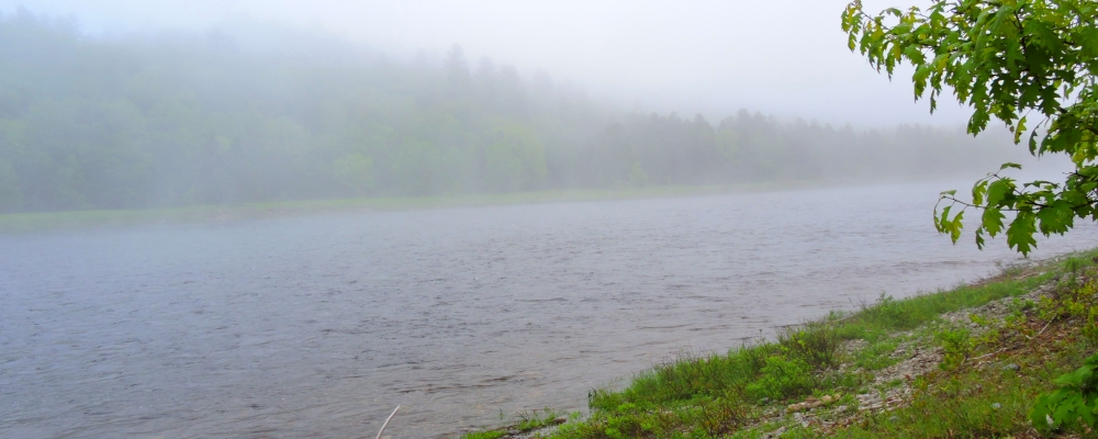
Upon arriving at the water′s edge, I drop my pack and begin to survey the river carefully. It looks much wider than the guide book reports it to be. Also, I deem this might be more than I have expected but I keep scrutinizing the water, the currents, the eddies for a long while, and then I notice a large series of ripples.
As I focus intently on these ripples, it occurs to me that wherever the river is rippling, the water there must be shallow, just as I have found this to be true at all of my previous fords.
Then, I scan the water looking for more ripples and I see several series of them. Further, I notice that many of the areas of these ripples are interconnecting. A smile comes to my face as I now know how to cross this river. Sitting down, I re-secure the cord holding the toe end of my boot together, making it taught.
While I am sitting, Ábabe trots up to me and gives me a nudge with her nose. She must want to get on with this crossing. So, I decide that I will try the first crossing with Ábabe at my side. We begin together with me holding her leash, stepping through shallow water across the first two sections of ripples. I move slowly due to the precarious footing, finding the rocks on the bottom to be loose, round and covered with a slippery slime.
Then we come to a channel where the water is moving quickly and there is a need to swim across a ten foot wide section to get to the shallow area on the other side. After the immersion, I decide that this channel would be hard or even impossible with a pack. Therefore I look around and then see fifty yards upstream where there is a series of ripples that cross this same channel.
Ha! I think, I will not have to swim that channel again!
We continue the crossing, often ankle deep, at times a bit deeper but we are able to move from one shallow area to another making fine progress in our effort to ford this wide watercourse.
At this point, I am downstream about seventy-five yards from where my pack still stands propped up and have zigzagged in the water for a distance of well over two hundred yards. I stop for a moment on a shallow gravel bar, where the water is only an inch deep and survey the river again.
Here, I determine we are about half the distance across and think this is totally incredible to be standing here in the midst of a raging river and be completely out of the water. Well, except for the bottom of my feet, of course.
Then I notice a hiker, in fact, I see it is Indigo, with his pack on, entering the water upstream of me right where the AT arrives at the Kennebec. I watch as he progresses but he goes in deeper and deeper and then at about one third of the distance across he is swimming in a channel. However, the channel is narrow and he makes it to shallow water again. I stand here totally amazed!
Then he continues directly across a second and then a third channel and makes it across by swimming each. I decide to wait to ensure he makes it across to the opposite bank and be ready to give him assistance if it becomes necessary.
Amazingly, he completes his ford of the river and climbs up the bank on the opposite side totally soaked and with water gushing out from several places in his pack. He made it!
I return my attention back to where I am in my ford of the river and have to move laterally several more times to stay in the shallows and then finally come within fifty feet of the opposite bank. The channel directly before me is much wider than the last one but with Àbabe unleashed I push right into it and begin swimming in the powerful current. She easily beats me across, shakes off and waits patiently for me to make it to the shore.
Finally, I step out of the water about sixty feet downstream from where I began swimming. This channel is absolutely too deep to cross wearing a pack and when I climb up out of the river onto the high bank, I begin to look for a better passage. From this vantage point, I am able to see clearly that last rippling gravel bar where I stood before swimming to shore. My eyes follow the ripples upstream along the gravel bar where the channel slowly moves toward the bank and nearly reaches the shore. Well, I believe I have found the route that will take me and my burden across this raging river and then allow me to step out of this most formidable water ford on the entire AT, safe and completely dry.
Total Trail Statistics:
Total Distance traveled on this day: 6.9 km (4.3 miles)
Total Distance traveled on the AT: 3302.9 km (2056 miles)
Total Number of Days Afoot on AT: 164 days
Daily Average traveled Afoot on AT: 20.14 km/day or 12.54 miles/day
|