The Wayƒarers Journal ©

The Journal

The Wayƒarers

The Selƒ

The Journey

The Burden

The Mountain

   The Ancients
   The Earth

     Geochronology
     Continents

       Africa
       Antarctica
       Asia
       Europe
       North America

         Geographical
         Geological

           Arches
           Blue Holes
           Canyons
           Caves
           Craters
           Deserts
           Forests
           Hot Springs
           Mountains
           Parks
           Rock Spires
           Viewpoints
           Volcanoes
           Waterways

       Oceania
       South America

     Oceans

   The Life
   The Modern Man
   The Nonpareils
   The Steps
   The Way

The Appendix

The Wayƒarer
The Mountain
Go to bottom of this page
THE VOLCANOES
The Capulin Volcano

The Capulin Volcano, New Mexico Go Down Go Up
Capulin Facts
Elevation: 8182 feet (2494 m)
Depth of Crater: 400 feet
Coordinates: 36.782222, -103.97
Last Eruption: 60,000 years ago
Volcano Type: extinct cinder cone volcano
Nearest City: five miles north of Capulin, NM
Range: Capulin is part of the Raton-Clayton Volcanic Field
Summits:
First Climbed:
Access to Summit: Paved Road
Age: 62,000 year old
Native Name: From choke cherry (Prunus virginiana)

Location, Park Status
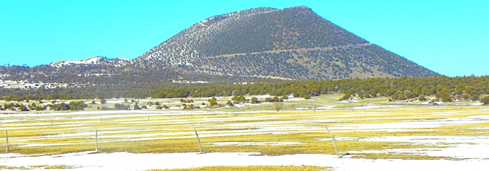
Capulin Volcano, located in northeastern New Mexico is an extinct cinder cone volcano that is part of the Raton-Clayton Volcanic Field. A paved road spirals around the volcano and visitors can drive up to a parking lot at the rim.
The volcano was designate a national monument on August 9, 1916 and is administered by the National Park Service. The visitor center features exhibits about the volcano, geology of the surrounding area, natural and cultural history, and offers educational programs about volcanoes. There is also a video presentation about the volcano.

Capulin Cinder Cone
Cinder cones, such as Capulin experience a single eruptive period and then die. The eruptive period can last as short as one year or as long as a decade. During the eruption, volcanic ash, cinders and rocks, blown thousands of feet into the air, blanket the surrounding landscape as the debris cools and falls. Also, layers of dust like ash, small cinder rocks and large chunks of cinder (called volcanic bombs) pile up around the vent to build the cone. Then, cinder cones, like Capulin die and eventually become extinct.

Raton-Claton Volcanic Field
Capulin volcano lies in the Raton-Clayton Volcanic Field, which has been periodically active. The western edge Raton phase was active 9 to 3 million years ago. The eastern side of the field, during the Clayton Phase, erupted more recently, between 3 and 2 million years ago. At the center of this field, Capulin volcano erupted approximately 60,000 years ago.
The name capulin comes from a type of black cherry, Prunus serotina, that is native to southern North America.

Mankind′s Search for Sustenance
While the geologic history of Capulin Volcano began well over a million years ago, its involvement in human history has been much more recent. Capulin has traditionally been a crossroads of human activity as diverse people and cultures traversed to and from the Great Plains in the hunt for large mammals.
Archaeological evidence found at the Folsom Man site, eight miles northwest of Capulin Volcano, confirms that from the first migration across the land bridge (about some time between 4000 BCE and 2000 BCE), the first wayfarers roamed this area in search of large mammals which included the Pleistocene Bison.
Likewise, groups of Native Americans, such as the Jicarilla Apache and the Ute, who were included in the third migration who crossed the land bridge (possibly some time between 1000 BCE and 500 BCE) used this region as hunting grounds until the arrival of the Spanish in 1541 CE.
Early explorers Don Francisco Vasquez de Coronado and Juan de Padilla passed through Capulin area in search of riches and regions to conquer paving the way for a greater influx of Europeans and resulting in a transformation of the cultural landscape over the next 350 years.

The 2010 Journey, Capulin Vocano Go Down Go Up
(Day 930 BR) 23°F.
Santa Fe Trail
Elevation: 6400 feet
Arriving at the Volcano
In the late afternoon, I arrive at Capulin Volcano National Monument, and when arriving at the entrance station, the ranger tells me that she is just about to close the park, but that I have just enough time to drive to the top because she also needs to drive up to insure everyone is on the way down.
The Capulin Volcano
Road to the Top
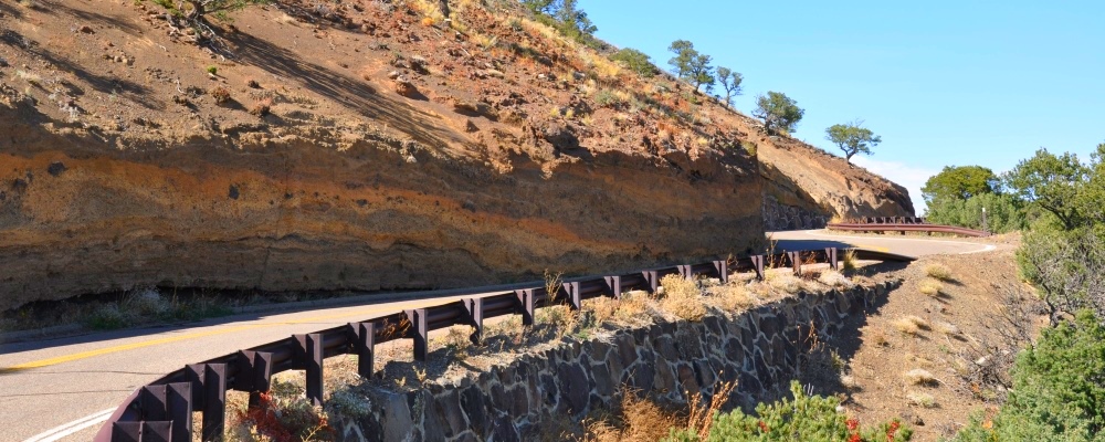
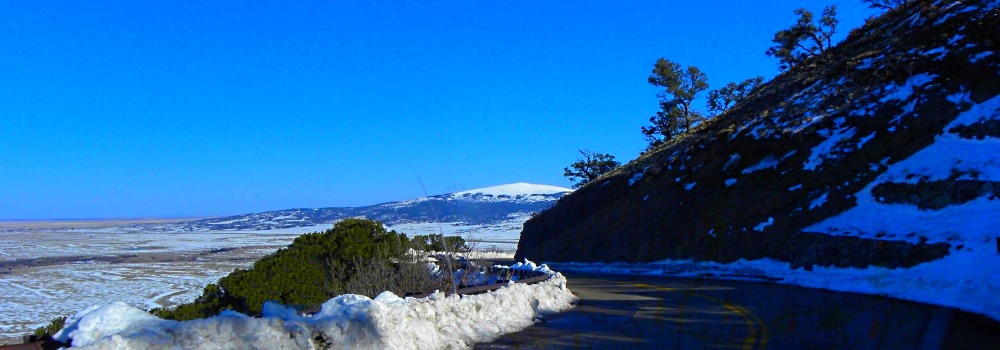
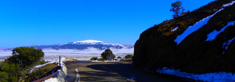
The road leading to the top of Capulin Volcano is called Volcano Road. This road is about two miles long and travels all the way to the crater rim.
Trailers and towed vehicles are not allowed on Volcano Road. Also, due to the fact that the road has no shoulders, bicycles and pedestrians are not permitted on the road during park hours. However, when the gate is closed and the road is closed to vehicles, then both bicycles and pedestrians are allowed.
The Capulin Volcano
(m2vo-nm-capulin-2010-1017.1356) The Capulin Volcano Road
The Capulin Volcano
(m2vo-nm-capulin-2010-0316.1614) The Capulin Volcano Road
The Capulin Volcano
(m2vo-nm-capulin-2010-0316.1615) The Capulin Volcano Road
Further, snow, ice, and severe thunderstorms may also cause park personnel to close the Volcano Road.

The Capulin Crater
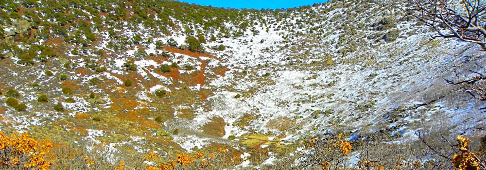
From the parking lot at the top of Capulin, there is a short 0.2 mile walk dropping 105 feet down to the bottom of the crater.
The Capulin Volcano
(m2vo-nm-capulin-2010-0316.1611) The Capulin Volcano Crater
Also, there is a 1 mile rim loop trail that circles the entire rim of Capulin crater. This trail has an elevation change of 305 feet and provides great views of the crater as well as the surrounding volcanic landscape.
The elevation on this trail is between 7800 feet and 8182 feet.
The Capulin Volcano
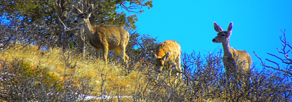
(m2vo-nm-capulin-2010-0316.1610) Deer Browsing near the Crater
Deer can often be seen browsing on top of Capulin.

View from the Top
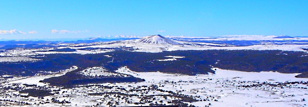
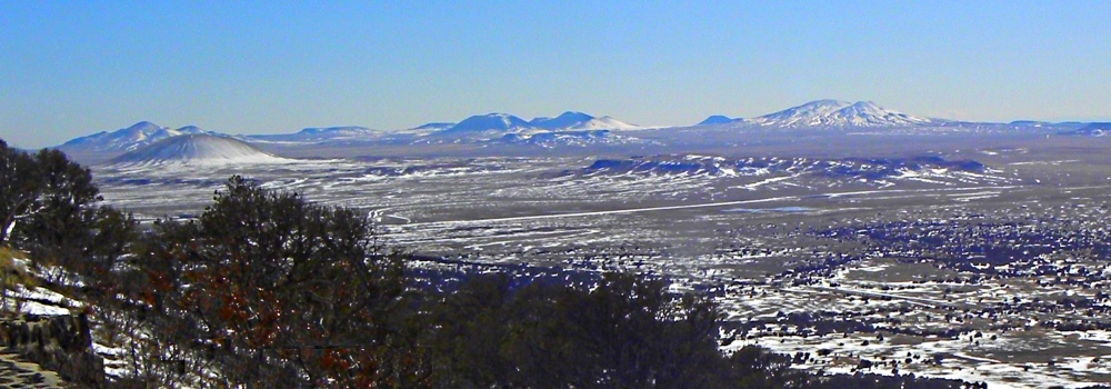
The Raton-Clayton Volcanic Field surrounding Capuline Volcano contains more than 100 recognizable volcanoes, all of which represent about 10 million years of the geological history in northern New Mexico.
Capulin Volcano is an outstanding landmark located in the northeast corner of New Mexico, where the rolling grasslands meet the foothills of the Sangre de Cristo Mountains. The highest point of Capulin Volcano provides unobstructed, panoramic views of the volcanic field, distant snow-capped mountains, and portions of a five state area including Colorado, Kansas, New Mexico, Oklahoma, Kansas, and Texas.
The Capulin Volcano
(m2vo-nm-capulin-2010-0316.1608) The Capulin Volcano View from the Rim
The Capulin Volcano
(m2vo-nm-capulin-2010-0316.1609) The Capulin Volcano View from the Rim
The Capulin Volcano
(m2vo-nm-capulin-2010-0316.1616) The Capulin Volcano View from the Rim
Visitors to Capulin Volcano and the visitors center are provide with an excellent opportunity to observe and understand volcanic formation.

To go back to the Gallery Index, click on down arrow. Go Back Go to previous section
on this page

Thank you for visiting The Wayƒarers Journal.

See Ya above the Treeline!

This Page Last Updated: 31 July 2026


To continue to the next Episode Level page, Click here go to top
 
The Wayƒarers Journal © ::: Come Join the Journey ™
by Thom Buras
Come Join the Journey ™