|
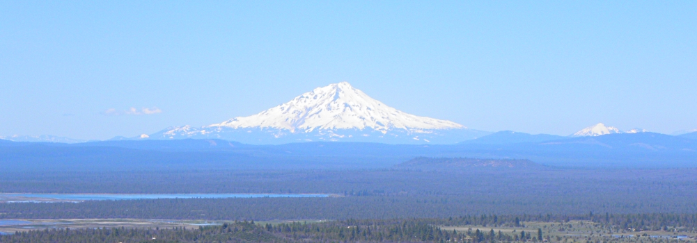
Mount Shasta Volcano
Mount Shasta (Úytaahkoo, which is White Mountain in the Karuk language), is a potentially active volcano at the southern end of the Cascade Range in northern California. Mount Shasta is the second highest peak in the Cascades and the fifth highest in the state.
Mount Shasta is connected to a satellite cone named Shastina, which together making an estimated volume of 85 cubic miles (350 km3), making them the most voluminous stratovolcano in the Cascade Volcanic Arc. There are in fact, four overlapping dormant cones that have built a complex shape.
Glaciation
There are seven named glaciers on Mount Shasta, with the four largest (Whitney, Bolam, Hotlum, and Wintun) radiating down from high on the main summit cone to below 10,000 ft (3,000 m) primarily on the north and east sides
The south side has the u-shaped Avalanche Gulch which is the largest glacial valley on Mount Shasta but it currently does not have a glacier in it.
Whitney Glacier is the longest glacier and Hotlum is the most voluminous glacier in California. Three smaller glaciers occupy cirques near and above 11,000 feet on the south and southeast sides which include the Watkins, Konwakiton and Mud Creek glaciers.
Mount Shasta Information
Elevation:
14,179 feet (4322 m)
Prominence:
9,772 feet (2979 m)
Age:
593,000 year old
Access to Summit:
Avalanche Gulch
First Climbed:
1854 E. D. Pearce and party
Last Eruption:
1786 CE
Mountain Type:
Strato (composite) volcano
Summits:
Shasta
(14,179)
Shastina
(12,335)
Location
Coordinates:
41.409196, -122.194888
Nearest City:
Mt Shasta, California
Range:
Mount Shasta is part of the
Cascade Volcanic Arc
Geographical Data
Geographical Region:
Pacific Coast
The Ancients
Second Migration
(The Uto-Aztecan Cultures)
In the current histroy, the Native American tribes who lived within view of Mount Shasta included the Achomawi (Achumawi), Atsugewi, Karuk, Klamath, Modoc, Okwanuchu, Shasta (Shastika), Wintu, and Yanan tribes; most of which are of the descendants of the Sons of Washeshuah, which are of the
Washoe family
The Earth
The Modern Man
The Steps
|