|

|
|
|

|

|
THE
EARTH
GALLERY

|
|
The North American Continent
|
|
|
The Geological Wonders:
Hot Springs & Geysers


|
|
|
Spence Hot Spring, New Mexico
The Spence Hot Spring, although in the beautiful San Diego Canyon surrounded by Santa Fe National Forest land, still is more effort to get to than what it is worth. First, the hike is more than a half mile of rock and ruts and roots on a steep trail on both sides of San Antonio creek.
Then, upon arriving at the hot spring, I found out that the water is only lukewarm, not even as hot as bath water. Needless to say, I did not stay long here, only rested up from the strenuous hike across the San Diego canyon, and then began the return trip back to the parking lot.
Spence Hot Spring Information:
Description:
Geological Type:
Hot Springs
Pool Temperature:
Hot Pool: 100 °
Hot Springs Access:
Pool Time Limits:
none
Reservations Required:
no
Walk-ins Welcome:
only way to get their
Maximum Capacity:
none
Hours of Operation:
not monitored
Location:
Address:
none
Phone:
none
Coordinates:
35.849450, -106.629770
Elevation:
feet
Nearest City:
Jemez Springs, New Mexico
Driving Direction:
Spence hot springs is located on state highway 4, just 6.5 miles north of the entrance to Jemez Historic Site in Jemez Springs, New Mexico.
Geographical Region:
Rocky Mountains
Fees:
Park Entrance Fees:
Pool Entrance Fees:
Other Site Fees:
Rating:
Three of Ten Stars
Rating Guide Selections:
C2, DX, H0, PT, SX, T1, W1, A2, A1
The Earth
National Parks and Monuments:
Bandelier National Monument (Petroglyph)
(35.796024, -106.275089)
Bandelier National Monuments Ruins
()
The Modern Man
Juniper National Monument Campground
(35.795164, -106.278876)
Bandelier National Monument
The Steps
|
| |
|
The 2019 Journey,
Spence Hot Springs
|
|
(Day
238 TG) 39°F. 6:30 am, sunny
Awake early, walk inside for coffee, com and computer. I check the internet for another near by hot springs and find one west of Los Alamos, New Mexico, not far above Jemez Springs on SH 4. I get the GPS coordinates and then pack out by ten this morning driving first on SH 30 south to SH 502, turn west and drive to Los Alamos. I stop first in town and then continue west on SH 502 and have to go through the guard gate of Los Alamos National Laboratory. Then, I continue west on SH 502 to where it intersects SH 4, which to the east is Bandelier, which national monument on Day
1080 BR I had already examined thoroughly to find both
petroglyph and
stone stackers.
So, instead, I turn west through Valles Caldera National Preserve, which I have also driven by but never gone into the preserve, mostly because it is all dirt roads. I continue on SR 4 to a canyon overlook and stop to see what is below. When looking down into the canyon, I realize that what I am looking at is my destination, the parking lot for the hot springs trail. I continue down into the canyon, park in the parking lot, get out my day hike gear, put on my hiking shoes and begin the half mile hike to the hot water.
Seems Like A Mile
The hike is a tough one for this old man, first down several long switchbacks to San Antonio creek, across a really nice footbridge, then a steep climb up through a rock jungle infested with muddy ruts. For a little while, methought I was back walking the AT in North Carolina were the trail there is replete with Rock and Roots and Ruts.


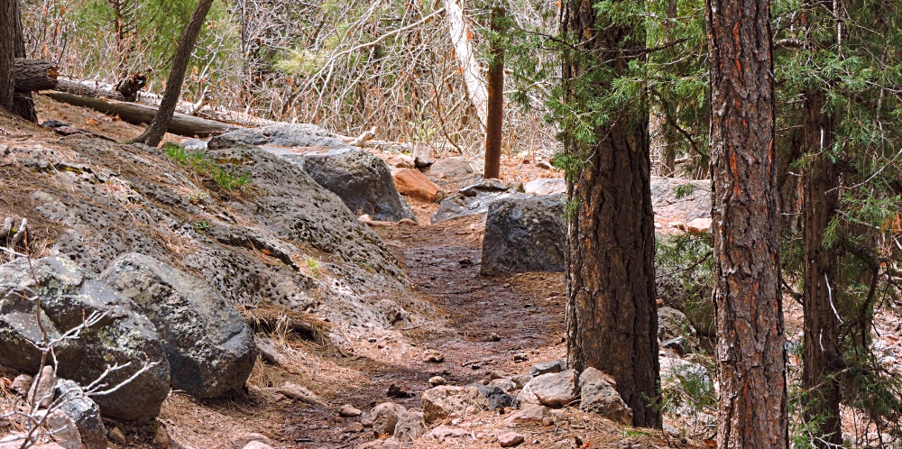
Barely Bath Hot
I do make it to the hot springs but it is truly not a hot spring but just warm, only about 100 degrees.
Again, I must say that the setting here is quite nice and just above the springs is a large clearing where it looks like some have camped.
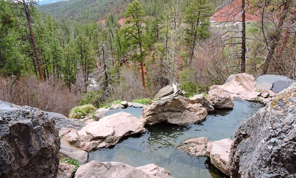
However, I don′t ever get in, but after taking some photos and resting up a bit, I begin the hike back to the parking lot.
|
| |
|
To go back to the Gallery Index, click on down arrow.
|
|
|
Thank you for visiting
The Wayƒarers Journal.
| |
See Ya above the Treeline!
| |
This Page Last Updated: 31 October 2026
|
|
|
|
To continue to the next Episode Level page,
Click here

|
|
| |



