|
Mammoth Hot Springs, Wyoming
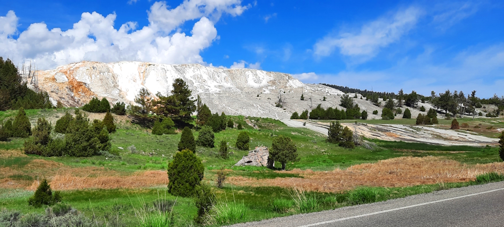
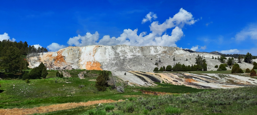
The Mammoth Hot Springs s a large complex of hot springs on a hill of travertine in Yellowstone National Park adjacent to
Fort Yellowstone and the Mammoth Hot Springs Historic District. It was created over thousands of years as hot water from the spring cooled and deposited calcium carbonate, which deposits amount to about two tons in a solution that flows into the Mammoth hot springs formation each day, coming from a large number of geothermal vents and causing the travertine flourishes.
The Mammoth Hot Springs actually are located outside of the Yellowstone Caldera, still all of the energy associated with the super volcano has been attributed to the same magmatic system that fuels other Yellowstone geothermal areas.
Mammoth Hot Springs Information:
Description:
The hot water that flow to Mammoth Hot Springs comes from Norris Geyser Basin after having traveled along an underground fault line in limestone that runs parallel to the Grand Loop Road between Norris and Mammoth features. The limestone within this rock formation fault line is the source of the calcium carbonate.
After leaving Norris Geyser, the superheated water cools slightly before surfacing at Mammoth Hot Springs at about 170° F
Thermal activity at Mammoth Hot Springs is extensive both through time and distance. Substantial variations in the travertine can occur, sometimes in just a few days but other time in several decades. Earthquakes can be frequent at Yellowstone and sometimes, an earthquake will shift the hot water vent and render any given terrace.
Terrace Mountain at Mammoth Hot Springs is the largest carbonate depositing spring in the world.
Travertine Colors
The colors of Mammoth Hot Springs travertine are tinted from algae living in the hot and warm waters. Colors include: brown, orange, red and green.
Geological Type:
Hot Springs
Water Temperature:
Source: Norris Geyser Basin
Mammoth Hot Spring Temperature: 170 ° F
Location:
Address:
Grand Loop Road, Yellowstone National Park, PO Box 168, WY 82190
Phone:
307.344.2263
Direction:
Mammoth Hot Springs is located near the North Entrance to Yellowstone on the Grand Loop Road.
Coordinates, Upper Terrace Loop:
44.9653601, -110.7077369
Elevation:
6615 feet
Coordinates, Lower Terrace Trailhead:
44.9695989, -110.7022927
Elevation:
6345 feet
Nearest City:
Fort Yellowstone, Wyoming
Geographical Region:
Rocky Mountains
Fees
Park Entrance Fees:
Per Vehicle: $ 35.00
Per Motorcycle: $ 30.00
Per Snowmibile: $ 30.00
Per Individual: $ 20.00
Access, Military and Senior Pass holders: $ Free
Other Site Fees:
The biggest myth that has been told about Yellowstone is that the pristine wilderness is untouched by humanity. Quite to the contrary, thousands of years before the Europeans arrived on this continent, the indigenous people were already camping, hunting and gathering, having been in Yellowstone for all of those thousands of years. In fact, once Yellowstone was established, the US Army was brought in to set up camp, push out all of the native people and keep them out while the US government told all of the public that Native Americans were never here in the first place because they were afraid of the geysers.
Yes, the area now known as Yellowstone park has been used by the indigenous people for thousands of years, and there has been found much evidence of human activity dating back for quite some time. There is a current total of 27 tribes that have historic connections to the lands and resources now found within Yellowstone National Park, including: the Assiniboine, Bannock, Blackfeet, Cheyenne River Sioux, Crow, Flathead, Nez Perce, Shoshone, Sioux, and others. Many of those tribes either lived here or traveled through the area to fish, hunt and gather food.
After some fourteen years of excavating in Yellowstone National Park, that extensive anthropological study proved one thing about the indigenous people. Anywhere anyone would want to pitch a tent, there are indigenous artifacts. In fact, the Native Americans were very much like the rest of us, they enjoyed camping on flat ground, close to water, and which also had a beautiful view.
River Valleys:
Firehole River Valley (southwest)
Upper Gallatin River Valley (northwest)
Gardiner River Valley (northcentral)
Hayden Valley (Yellowstone River below Lake)
Lamar River Valley (northeast)
Lewis River Valley (south)
Lower Yellowstone River Valley (Tower-northcentral)
Madison River Valley (west)
Nez Perce Creek Valley (westcentral)
Snake River Valley (southcentral)
Upper Yellowstone River Valley (southeast)
Note: Except for the Lewis and Snake Rivers, all rivers are east of the continental divide and flow north to the Missouri River.
Mountain Ranges:
Absoroka Range (east side)
Gallatin Range (north west)
Red Mountains (south)
Washburn Range (north centeral)
Fort Yellowstone
|