The Wayƒarers Journal ©

The Journal

The Wayƒarers

The Selƒ

The Journey

The Burden

The Mountain

   The Ancients
   The Earth

     Geochronology
     Continents

       Africa
       Antarctica
       Asia
       Europe
       North America

         Geographical

           Arctic Mtns
           Greenland Isl
           CAN Lowlands
           CAN Shield
           Int. Lowlands
           Rocky Mtns
           Basin-Range
           Pacific Coast
           Great Plains
           Appalachian
           Int. Highland
           Coastal Plains
           N. Sierra Mad.
           Volcanic Mtns
           S. Sierra Mad.
           S. M. de Chipas
           S. Pacific Cst
           Island Lands
           Continent Shelf

       Oceania
       South America

     Oceans

   The Life
   The Modern Man
   The Nonpareils
   The Steps
   The Way

The Appendix

The Wayƒarer
The Mountain
Go to bottom of this page
THE GEOGRAPHICAL REGIONS
The Basin and Range, Arizona

The Escarpment Ecoregion Go Down Go Back
The Escarpment
This area trends from the lower eastern part of the state in a northwestern direction through the central portion of the state. This area consists of rugged mountain ranges and valleys. Most mountains are part of the Mogollon Rim, a dramatic escarpment extending more than one hundred miles from the New Mexico line northwesterly along the northern part of the escarpment area.

NNN Information:
Description:
Location:
Coordinates:
Elevation: feet
Geographical Region: GGG
Ecoregion: EEE

Ancient Steps:

Campgrounds:
Mogollon Rim Recreational Area

Land forms:
Mazatzal, Santa Maria, Sierra Ancha and the White Mountains.

Parks:

Sites:
Mongollon Rim Visitors Center
Lakes Vista Overlook
Military Sinkhole Overlook

The 2021 Journey, Escarpment Ecoregion Go Down Go Up
(Day 163 TN) 36°F. 6:00 am, sunny
Journey On, Day 67

Up to the Mogollon Rim
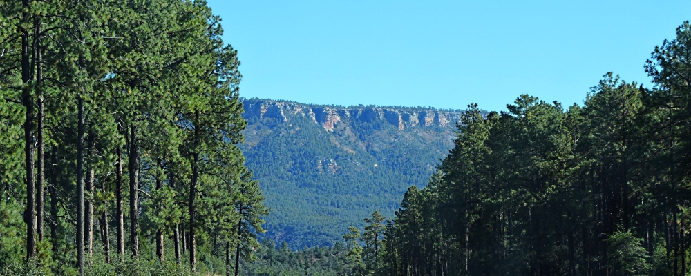
The drive from Payson, Arizona up to the Mogollon Rim visitors center is only about thirty miles distance, however, there is a climb of about 2,500 feet in elevation up to the Mogollon Rim. Along the drive up to the rim of the plateau, I am always ready to talk a photo of any spots where I can see the rim from the roadway. Leaving Payson, the highway drops into a valley and from this viewpoint, I can see the rim in the distance and that the travel to the Mogollon Rim will be across a large valley replete with many canyons and hills.
As I travel down into this valley, the ability to see the rim diminishes greatly and I only get glimpses of it occasionally.
The Basin and Range
The Escarpment Ecoregion
(m2cont-nam-geog-07-az-7n-2021-1027.1003) The Climb up to the Mogollon Rim
The Basin and Range
The Escarpment Ecoregion
(m2cont-nam-geog-07-az-7n-2021-1027.1005) The Climb up to the Mogollon Rim
The Basin and Range
The Escarpment Ecoregion
(m2cont-nam-geog-07-az-7n-2021-1027.1017) The Climb up to the Mogollon Rim
The Basin and Range
The Escarpment Ecoregion
(m2cont-nam-geog-07-az-7n-2021-1027.1020) The Climb up to the Mogollon Rim

Getting Close to the Rim
As I continue, I watch my GPS monitor and it shows that the elevation is fast approaching 7000 feet, I begin to see the edge of the rim clearly.
The Basin and Range
The Escarpment Ecoregion The Basin and Range
The Escarpment Ecoregion
Looking back at my GPS, I see that the Rim Road is now showing up on the monitor and I know that I am close. Then, suddenly, there it is, the Rim of the Canyon right out my window. In no time, I arrive at the visitors center.
The Basin and Range
The Escarpment Ecoregion
The Escarpment
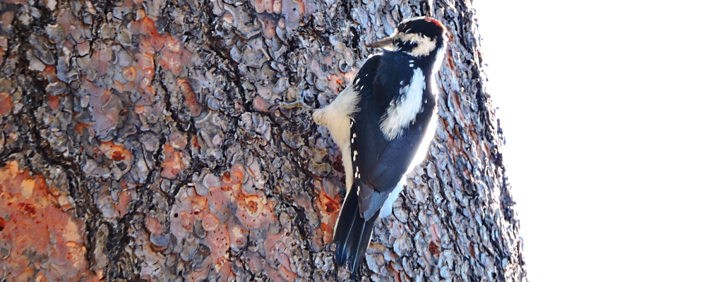
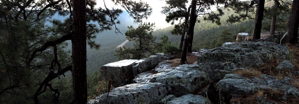
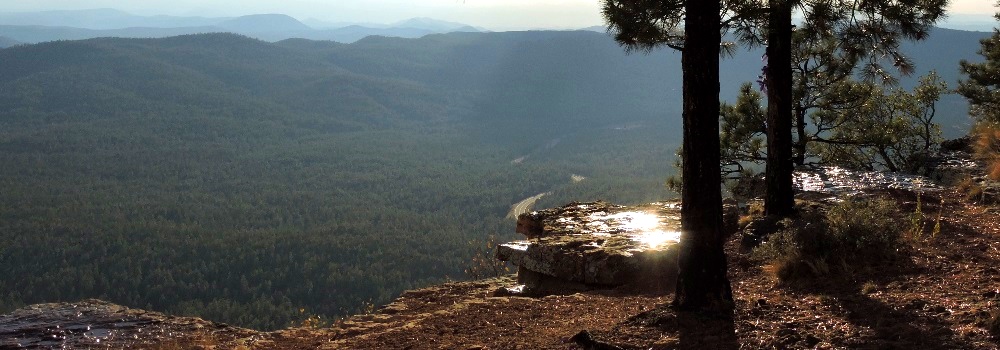
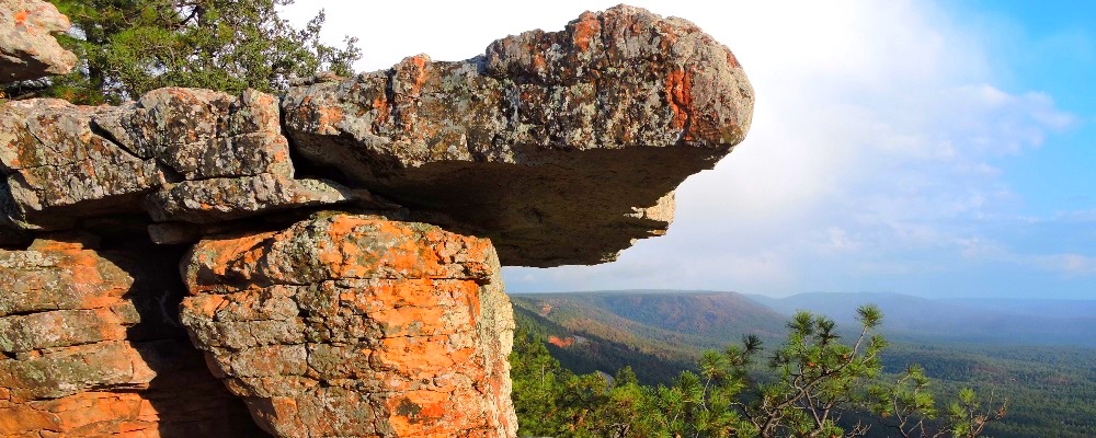
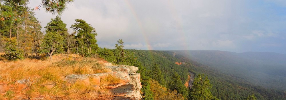
The first stop is at the Mogollon Rim visitors center, which is already closed for the winter, and walk to the rim here to photograph the canyon. I hear a woodpecker overhead and try to take photos but the sun is right in my eyes. Moving about the area allows me to finally see the bird and get some photos of him, but I am not able to ID him as a hairy woodpecker until I upload the photos to my computer. I then continue along the Rim drive in the Mogollon Rim Recreational Area where I stop at the a couple of the observation stops to take more photos.
The Basin and Range
The Escarpment Ecoregion
(m2cont-nam-geog-07-az-7n-2021-1027.1037) The Mogollon Rim Visitors Center
The Basin and Range
The Escarpment Ecoregion
(m2cont-nam-geog-07-az-7n-2021-1027.1038) View from the Rim at Visitors Center
The Basin and Range
The Escarpment Ecoregion
The Rim Road
Next, I drive across SH 260 and turn left on the Rim road (FS road 300), a scenic drive that travels for over forty miles along the Mogollon Rim at the edge of the Arizona Escarpment. The drive offers scenic views at countless lookouts, has campsites and hiking trails all along the way.
After 1.2 miles, FR 300 intersects what used to be the General Crook Trail, a historic wagon route that was used in the 1870s and 1880s to provide logistical support for General George Crook in the U.S. Army’s war against the Apaches.
The Rim Road is one that I intend to return to and travel the entire length someday not to distant in the future, but I will have to come at an earlier time in the year when it is actually open.
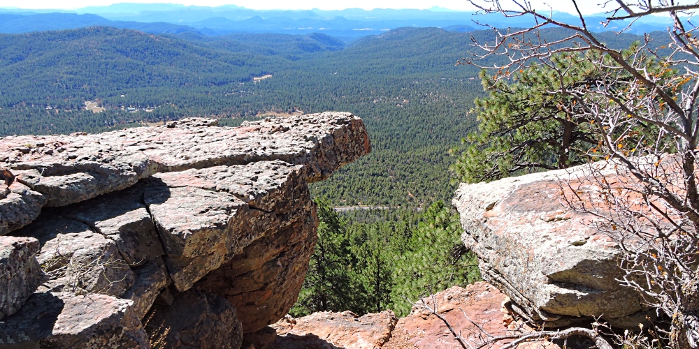
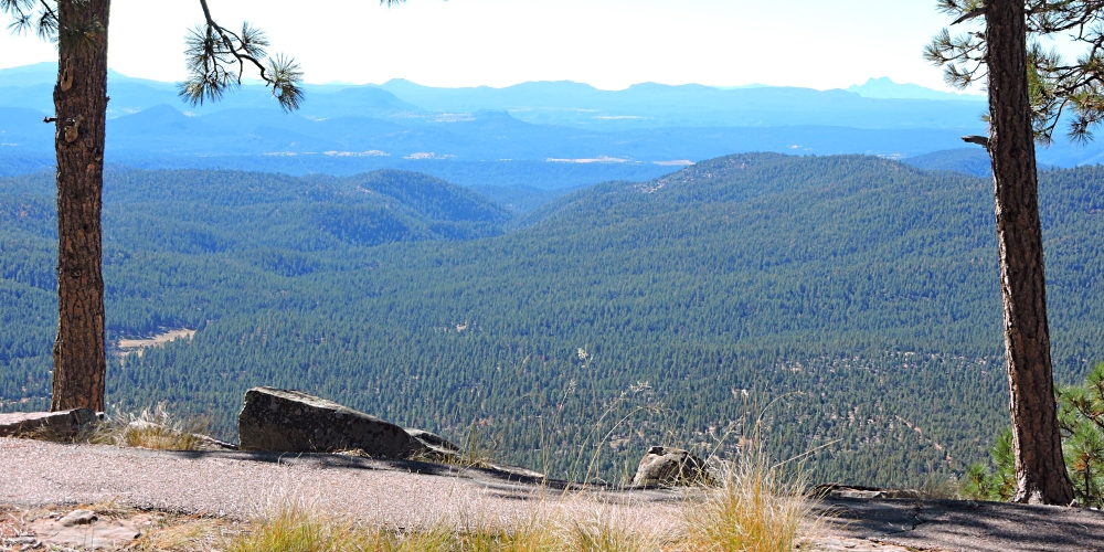
However, for today, I only travel to two of the overlooks, the Military Sinkhole overlook and then the Rims Lakes Vista overlook.

Military Sinkhole Overlook
The Basin and Range
The Escarpment Ecoregion
(m2cont-nam-geog-07-az-7n-2021-1027.1050) View from The Military Sinkhole Overlook
The Basin and Range
The Escarpment Ecoregion
(m2cont-nam-geog-07-az-7n-2021-1027.1051) View from The Military Sinkhole Overlook
The Basin and Range
The Escarpment Ecoregion
(m2cont-nam-geog-07-az-7n-2021-1027.1052) View from The Military Sinkhole Overlook
The Basin and Range
The Escarpment Ecoregion
(m2cont-nam-geog-07-az-7n-2021-1027.1053) View from The Military Sinkhole Overlook
The Basin and Range
The Escarpment Ecoregion
(m2cont-nam-geog-07-az-7n-2021-1027.1054) View from The Military Sinkhole Overlook
The Basin and Range
The Escarpment Ecoregion
(m2cont-nam-geog-07-az-7n-2021-1027.1059) View from The Military Sinkhole Overlook

Lakes Vista Overlook
The Basin and Range
The Escarpment Ecoregion
(m2cont-nam-geog-07-az-7n-2021-1027.1102) The view from the Lakes Vista Overlook
The Basin and Range
The Escarpment Ecoregion
(m2cont-nam-geog-07-az-7n-2021-1027.1103)The view from the Lakes Vista Overlook
The Basin and Range
The Escarpment Ecoregion
(m2cont-nam-geog-07-az-7n-2021-1027.1104)The view from the Lakes Vista Overlook
The Basin and Range
The Escarpment Ecoregion
(m2cont-nam-geog-07-az-7n-2021-1027.1105)The view from the Lakes Vista Overlook
The Basin and Range
The Escarpment Ecoregion
(m2cont-nam-geog-07-az-7n-2021-1027.1106)The view from the Lakes Vista Overlook
The Basin and Range
The Escarpment Ecoregion
(m2cont-nam-geog-07-az-7n-2021-1027.1107)The view from the Lakes Vista Overlook
The Basin and Range
The Escarpment Ecoregion
(m2cont-nam-geog-07-az-7n-2021-1027.1108)The view from the Lakes Vista Overlook

Return to SH 260
At this overlook, I stop and because the previous three campsites have already been closed for the winter, I do not drive the extra three miles to Mogollon Rim campsite seven, giving up on camping here tonight, but turn around and drive back to SH 260 and resume my journey east to my winter hiatus.
Once again, methinks, I want to return here to drive and camp the forty miles of this remarkable scenic route.

The 2016 Journey, Escarpment Ecoregion Go Down Go Up
Mogollon Rim Recreationa Area Mogollon Rim Recreationa Area
(m2cont-nam-geog-07-az-7n-2016-1103.1607) Upon arriving at the Mogollon Rim Escarpment
Mogollon Rim Recreationa Area
(m2cont-nam-geog-07-az-7n-2016-1103.1616) Views from the top edge of the rim escarpment
Mogollon Rim Recreationa Area
(m2cont-nam-geog-07-az-7n-2016-1103.1617) Views from the top edge of the rim escarpment
Mogollon Rim Recreationa Area
(m2cont-nam-geog-07-az-7n-2016-1103.1618) Views from the top edge of the rim escarpment
Mogollon Rim Recreationa Area
(m2cont-nam-geog-07-az-7n-2016-1103.1619) Views from the top edge of the rim escarpment
Mogollon Rim Recreationa Area
(m2cont-nam-geog-07-az-7n-2016-1103.1620) Views from the top edge of the rim escarpment
Mogollon Rim Recreationa Area
(m2cont-nam-geog-07-az-7n-2016-1103.1621) Views from the top edge of the rim escarpment
Mogollon Rim Recreationa Area
(m2cont-nam-geog-07-az-7n-2016-1103.1622) Views from the top edge of the rim escarpment
Mogollon Rim Recreationa Area
(m2cont-nam-geog-07-az-7n-2016-1103.1623) Views from the top edge of the rim escarpment
Mogollon Rim Recreationa Area
(m2cont-nam-geog-07-az-7n-2016-1103.1625) Views from the top edge of the rim escarpment
Mogollon Rim Recreationa Area
(m2cont-nam-geog-07-az-7n-2016-1103.1626) Views from the top edge of the rim escarpment
Mogollon Rim Recreationa Area
(m2cont-nam-geog-07-az-7n-2016-1103.1627) Views from the top edge of the rim escarpment
Mogollon Rim Recreationa Area
(m2cont-nam-geog-07-az-7n-2016-1103.1628) Views from the top edge of the rim escarpment
Mogollon Rim Recreationa Area
(m2cont-nam-geog-07-az-7n-2016-1103.1629) Views from the top edge of the rim escarpment
Mogollon Rim Recreationa Area
(m2cont-nam-geog-07-az-7n-2016-1103.1631) Views from the top edge of the rim escarpment
Mogollon Rim Recreationa Area
(m2cont-nam-geog-07-az-7n-2016-1103.1632) Views from the top edge of the rim escarpment
Mogollon Rim Recreationa Area
(m2cont-nam-geog-07-az-7n-2016-1103.1633) Views from the top edge of the rim escarpment
Mogollon Rim Recreationa Area
(m2cont-nam-geog-07-az-7n-2016-1103.1634) Views from the top edge of the rim escarpment
Mogollon Rim Recreationa Area
(m2cont-nam-geog-07-az-7n-2016-1103.1635) Views from the top edge of the rim escarpment
Mogollon Rim Recreationa Area
(m2cont-nam-geog-07-az-7n-2016-1103.1636) Views from the top edge of the rim escarpment
Mogollon Rim Recreationa Area
(m2cont-nam-geog-07-az-7n-2016-1103.1637) Views from the top edge of the rim escarpment

To go back to the Gallery Index, click on down arrow. Go Back Go to previous section
on this page

Thank you for visiting The Wayƒarers Journal.

See Ya above the Treeline!

This Page Last Updated: 30 June 2026


To continue to the next Episode Level page, Click here go to top
 
The Wayƒarers Journal © ::: Come Join the Journey ™
by Thom Buras
Come Join the Journey ™