|

|
|
|

|

|
|
|
The National Road:
Ohio


|
|
The National Road Information
National Road Description:
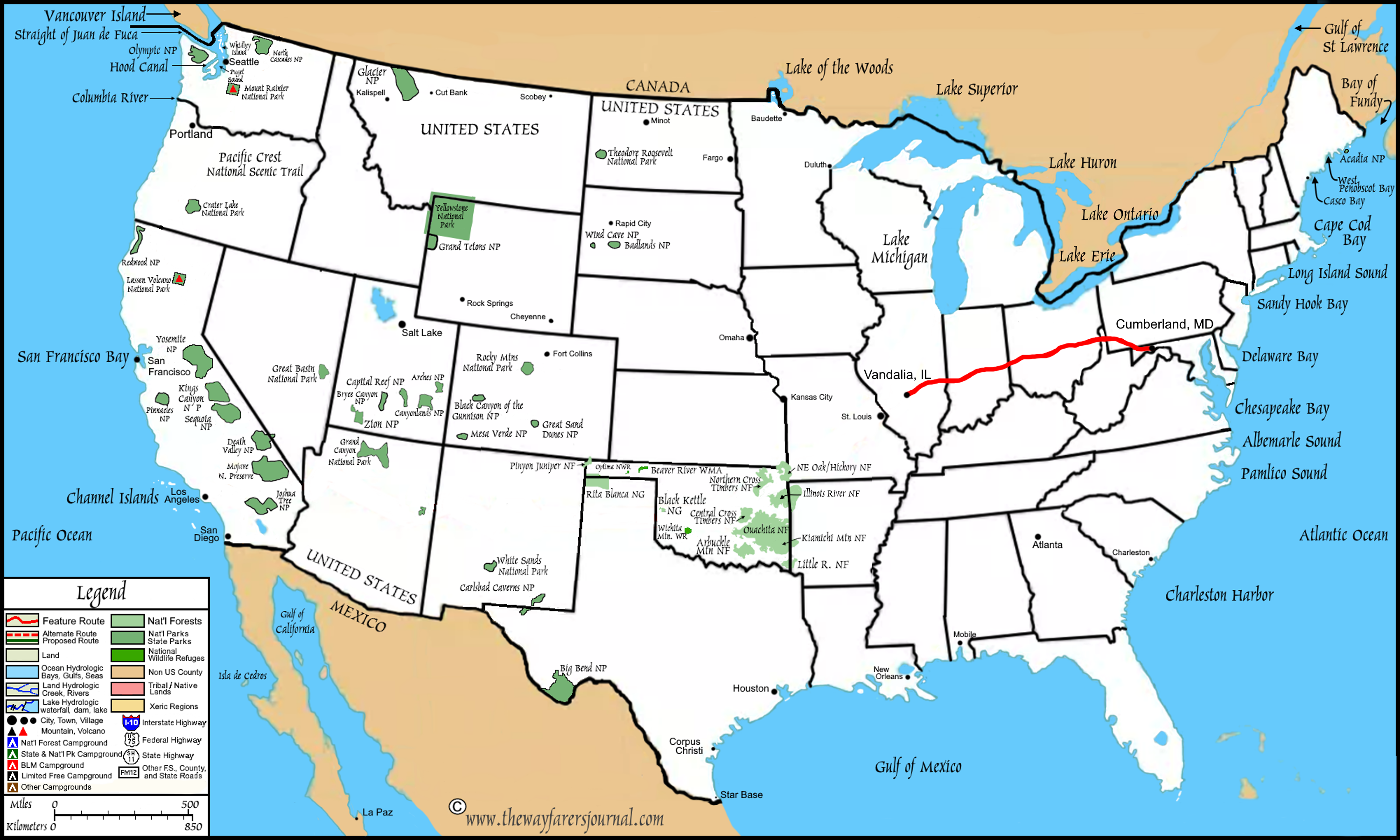
The National Road was the first major US highway that was built with federal funds, authorized by President Jefferson in 1806 to connect the Potomac river in Cumberland, Maryland with the Ohio River. Construction began in 1811, reaching the Ohio river by 1818, and eventually completing a roadpath to Vandalia, Illinois by 1839. The National Road served as a vital, historic artery for westward expansion for migration of settlers, it impacted commerce and it opened up the Mississippi River basis for US westward expansion.
The National Road became a major route for early automobile travel, and eventually became US Highway 40. Today, the old roadpath is largely followed by U.S. Route 40, with many sections designated as a scenic byway, with the communities and/or states preserving historic inns, markers, bridges and sections of roadpath.
The original road was built using surveys, right-of-way acquisition, grading, then installing masonry foundations and stone surfacing. Then, in the early 1900s, most of that original road was re-placed with a re-built roadpath composed of a concrete foundation with brick overlay.
National Roadpath Map:

| |
|
The National Road:
The Path in Ohio
|
|
|
State Roadpath Description:
National Road: Western Ohio
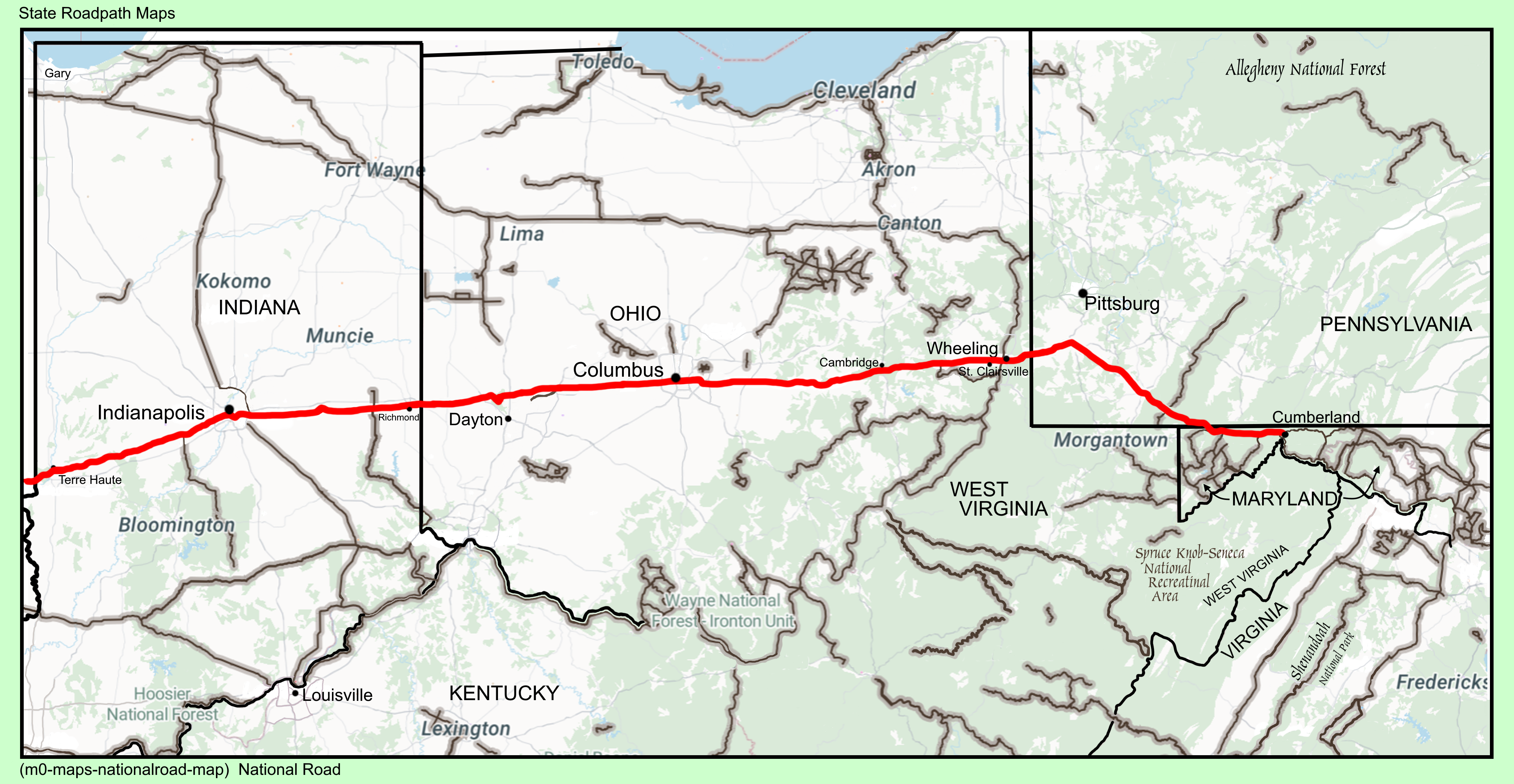
The Historic National Road in Ohio, often referred to as The Pike, is a 228-mile All-American Road that follows US Route 40 across the state. The Roadpath was authorized in 1806 as the first federally funded interstate highway in U.S. history, designed to connect the eastern seaboard with the western frontier. The byway enters Ohio from West Virginia at Bridgeport and exits near Richmond, Indiana, traversing 10 counties: Belmont, Guernsey, Muskingum, Licking, Franklin, Madison, Clark, Miami, Montgomery, and Preble.
The Historic National Road Byway is lined with pike towns which grew up around stopping points for foot and horse powered traffic in the early 1800s. The road began to decline by 1850 as the feeling in the country and in Congress was that railroads made roads and canals obsolete for long distance transportation. The invention of the first recognizably modern bicycle and the modern automobile, both in 1885, sparked a renewed interest in roads, including the National Road. Most of the alignment of the National Road was incorporated into US 40 when the national route system went into effect in 1926.
Much of what I experienced along The Pike in Ohio were narrow two story homes with six to eight windows facing the front normally with a hip roof on both the front and rear with gable ends. Most all of these homes were built in and around farming communities and each farm also included a barn, silos and sometimes other outlying buildings. However, in the pit towns, I found the same architecture in the homes, but only many homes built side by side down the roadpath.
National Road: Eastern Ohio
Arriving in Columbia, Ohio, I found this city to have the worst roads I have experience since leaving Texas some months ago. Methinks, if i ever drive thought this city, I will instead of driving the city streets, choose to bypass this megalopolis entirely by driving the circular bypassing interstate highways.
State Roadpath Information:
Roadpath Type:
Historic, All American Road, 2002
Roadpath Length:
Original: 1811-1839
225 miles
Reconstruction 1900s to Present:
228 miles
Roadpath Terminus Point One:
Location West:
State Line at Richmond, Indiana
Coordinates:
39.8334009800018, -84.81387460120114
Elevation:
1,123 feet
Roadpath Terminus Point Two:
Location East:
Bridgeport, Ohio
Coordinates:
40.07231401170148, -80.73909525223318
Elevation:
671 feet
Roadpath Highest Elevation:
1,145 feet,
Indiana State Line
Roadpath Lowest Elevation:
671 feet,
West Virginia State Line
Roadpath History:
Geographic Information:
Western Geographical Region:
Interior Lowlands
Eastern Geographical Region:
Appalachian Mountains
|
| |
|
The 2026 Journey:
Ohio National Road
|
|
|
(Day 802 TS) 55°F. 6:30 am, sunny
Journey On™, Day 68
Upon leaving the w-mart this morning, I turn left onto US 40 and drive east out of Richmond, Indiana and almost immediately, I cross into the state of Ohio.
The drive today was as I had already discerned from my research, that when I cross Ohio on US 40, I will travel through two entirely different regions: First, from the Indiana state line, I will continue across the very flat and low elevations of the Interior Lowlands Region and that without very much elevation changes. Next, after I travel through Columbus, Ohio, and while still in Ohio, I will begin the transition into the second Geographical Region, which is the Appalachian Mountains Region.
Western Ohio
Rural Landscapes
The primary structure which dominates the rural landscape throughout my drive in Ohio are the farmsteads, most of which appear to be self-sufficient, agriculture-based home businesses. The buildings include in the farmstead are the house, barns, sheds, chicken coops, silos, all of which are surrounded by the outlying fields with several areas in varied stages of crop production.
The family home are usually a wood two story, colonial style building having gable ends and a small covered front stoop and often the rear of the home has an attached extended shed structure (some buildings have an complete wing added).

(m6fi-national-oh-2026-0423.1314) The National Road, Ohio: Farmstead w/double rear shed

(m6fi-national-oh-2026-0423.1437) The National Road, Ohio: Farmstead with rear shed

(m6fi-national-oh-2026-0423.1440) The National Road, Ohio: Farmstead with rear wing
Some of the farmstead homes are of colonial foursquare architecture.

(m6fi-national-oh-2026-0423.1318) The National Road, Ohio: Farmstead, foursquare built.
Small Towns
However, in the small towns, the homesteads consist of primarily colonial architecture built side by side in rows, many of which are foursquare in construction. Too, I have been noticing that a primary feature of these colonial homes in the towns are their brick chimneys atop the roofs.

(m6fi-national-oh-2026-0423.1418) The National Road, Ohio: foursquare w/brick chimneys

(m6fi-national-oh-2026-0423.1419) The National Road, Ohio: two-story front porch
The Lay of the Land
From first entering this state, the lay of the land has been near completely flat, as I would say when growing up on the
Texas Coastal flat plains, "It is so flat here, the only time we have a rise in elevation is when we step up onto a curb." In eastern Ohio, this is also true.

(m6fi-national-oh-2026-0423.1443) The National Road, Ohio: flat lands

(m6fi-national-oh-2026-0423.1446) The National Road, Ohio: highway signage
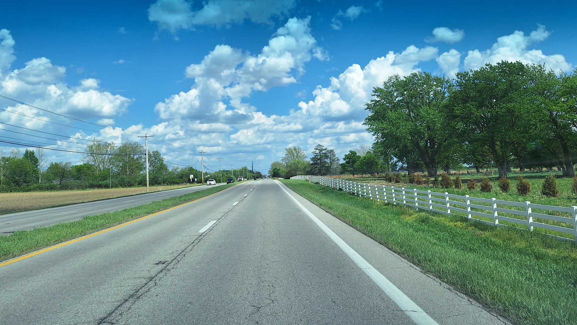
(m6fi-national-oh-2026-0423.1502) The National Road, Ohio: Looks more like Kentucky
Columbus: The City
The drive on the National Road brings me into the city of Columbus which is still within the the Interior Lowlands Region. When I come upon the sign stating Welcome to Columbus, I have already been seeing the skyscrapers in the distance ahead of me and continuing on US 40, the road name becomes Washington Street. Driving in this city, I find this to be the city with the worst streets so far since I began driving on this Journey On back in south Texas.

(m6fi-national-oh-2026-0423.1534) The National Road, Columbus Ohio: The City

(m6fi-national-oh-2026-0423.1544) The National Road, The City Wall Mural

(m6fi-national-oh-2026-0423.1550) The National Road, The City Deteriorating Infrastructure

(m6fi-national-oh-2026-0423.1550) The National Road, Columbus Ohio: The City
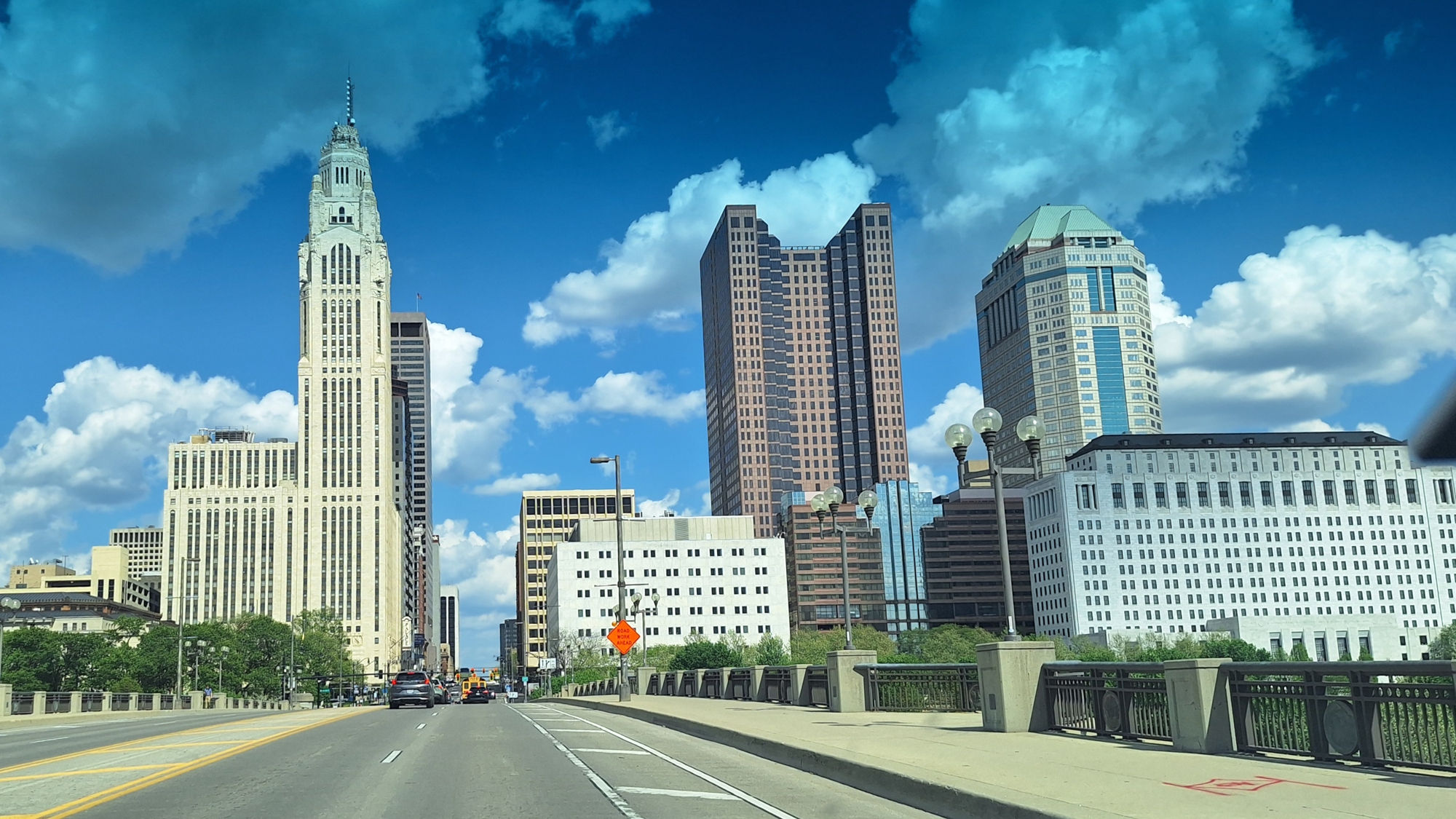
(m6fi-national-oh-2026-0423.1550) The National Road, Columbus Ohio: The City

(m6fi-national-oh-2026-0423.1550) The National Road, Scioto River and the Discovery Bridge
Upon crossing the Scioto River, I arrive at a sign indicating that US Highway 40 has been closed ahead, I continue on West Broad bur before arriving at High Street in the center of downtown, I must needs take a detour around the downtown section of the Nation Road in Columbus, Ohio. Here the traffic becomes really bad as well as the condition of the streets. Methinks, I will make it a point to not return to this city.

(m6fi-national-oh-2026-0423.1550) The National Road, Downtown Signage and Road Closure
After continuing on the detour, I arrive back on the National Road, but definitely outside of the downtown area. Finally, the traffic improves but the city streets do not get much better until a few miles later.
Eastern Ohio

(m6fi-national-oh-2026-0423.1655) The National Road, Eastern Ohio, Farmstead

(m6fi-national-oh-2026-0423.1701) The National Road, Eastern Ohio, Farmstead
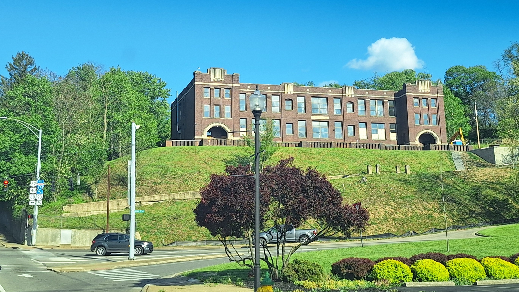
I had just past Hebron, Ohio when up ahead of me, I see my first glimpse of the Appalachian Mountains. Sure, what is in this photo is not a very high mountains, I know that but the hill above is a far cry higher than a curb. So, from this point eastward on my 2026 Journey On™ I will be driving in the
Western Allegheny Plateau Ecoregion. Well, at least until I drive out of this plateau ecoregion and drive into the
Central Appalachian Mountains in Pennsylvania.




|
| |
| |
|
To go back to the Gallery Index, click on the down arrow.
|
|
|
Thank you for visiting
The Wayƒarers Journal.
| |
See Ya above the Treeline!
| |
This Page Last Updated: 31 October 2026
|
|
|
|
To continue to the next Episode Level page,
Click here

|
|
| |



