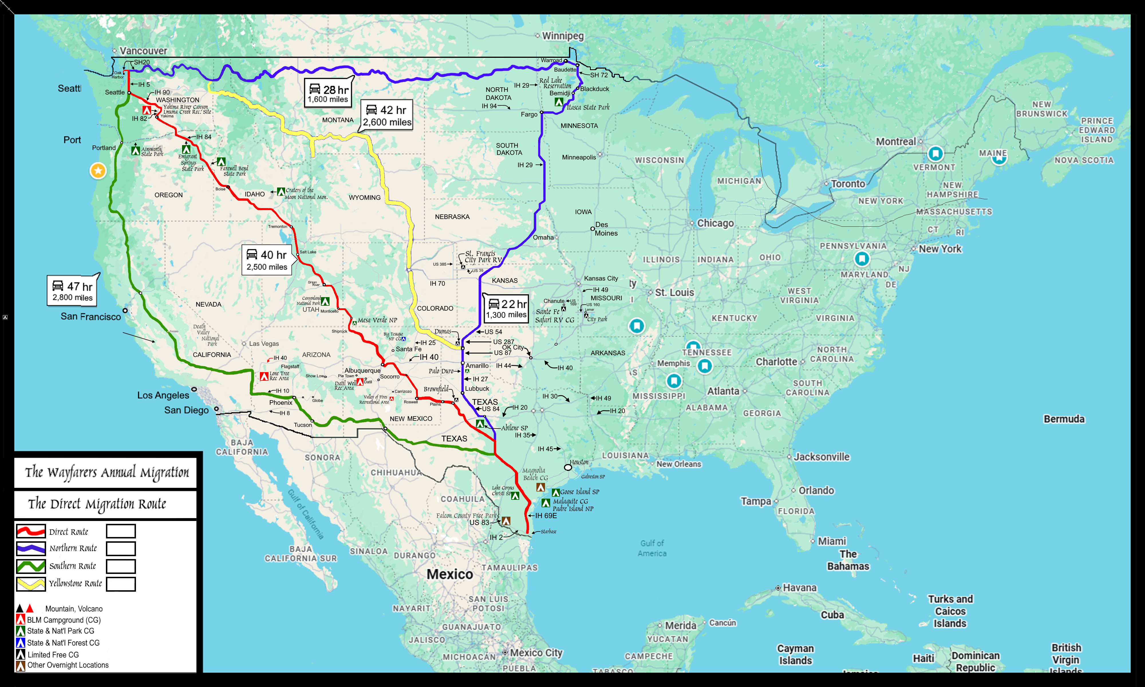
|
Journey On™ Southbound Begins
Section One: WA, OR, ID
First Leg: The Drive South to Vancouver
250 miles, 4 hours (+ 1 hour construction delay)
(Day
969 TS) 52°F. 6:30 am, overcast
After nearly an entire day pounding keys in the Oak Harbor, Washington at the uptown w-mart, I finally pack out to the Jammer, start the engine. However, there are several tasks that must need be done before I can even begin the drive north out of Oak Harbor.
Once all of those tasks are behind me, I feel that I can finally begin this 2026 annual southbound migration, and in only a few minutes, I cross over Deception Pass Bridge.

(m4bridge-cantilever-wa-deception-2026-0921.1604)
Deception Pass Bridge (view east)
Immediately past the Deception Pass Bridge, I make my first stop north of town is the Bowman Bay campground for one last free hot shower before my southbound roadpath journey begins.

(b4wheels-1996-2026-0921.1634) 1996 Aerostar at
Bowman Bay Campground
Then, driving north and then east on SH 20; a very familiar roadpath, I arrive at the first major intersection, which is Interstate Highway 5 (IH5), and turn south. Continuing on this first leg of my southbound annual migration will add another 250 miles in distance and which requires about four hours of driving to achieve. The drive through Everett, Seattle, Renton and Tacoma is nice, and I am able to drive most all of this stretch at or just below the speed limit.

(m6fi-migration-dir-2026-image) 2026 Journey, Seattle Sky Line


However, somewhere after Tacoma, I arrive at a stretch of IH 5 that has all but one lane closed for repairs and that short two mile long repair has me driving at a turtle-pace for most nearly all of one hour before the interstate opens wide again and I am able to travel again at the speed limit.
Thus, it is nearly eight this evening when I arrive at the hf-mart in Vancouver, Washington, drive into its parking lot and find a space in th,e outer area to overnight. parking lot.
(Day 970 TS) 52°F. 6:30 am, sunny
Journey On™, Day One
Equinox: Autumnal Equinox (US: 19:05 CDT)
Moon: Waxing Gibbous (19-25 Sept. late afternoon/evenings)
Constellation: AQR. Illumination: 84 percent
Awake, arise and when the OPEN sign is turned on, I walk into the hf-mart and begin shopping for my food stores. After about two hours in the store, I check out with a receipt of over four hundred dollars and what I purchased only filled two grocery bags. Wow, that was expensive! I even told the cashier "I can remember when I only had to pay Ten Dollars for one grocery bag of groceries." I walkd back out to the jammer and stow my food inside, in the rear and then I drive to the w-mart for coffee, com and computer.
Then, at sunset, I walk out to the jammer, start the engine and drive back to the hf-mart parking lot to overnight again.
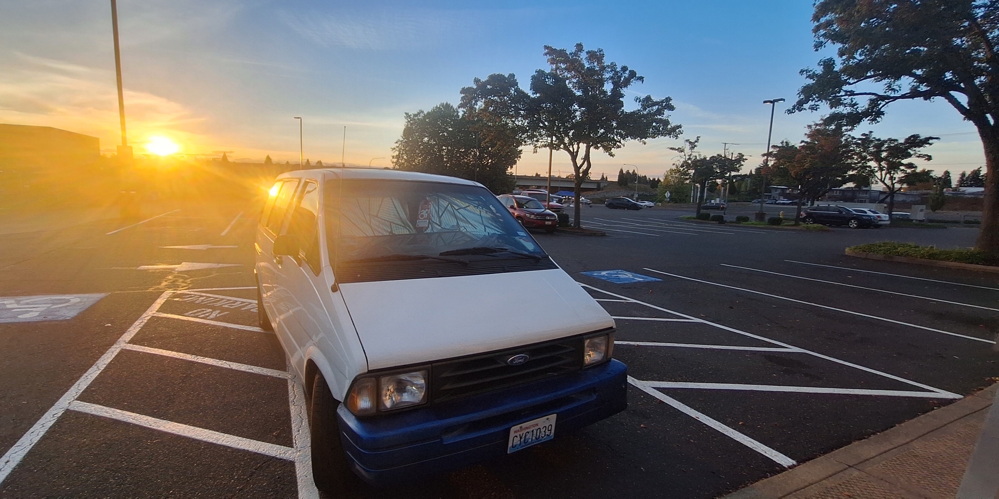
(b4wheels-1996-2026-0923.1847)
Suntouch while Pounding Keys in the w-mart
Journey On™ Southbound
Section One: WA, OR, ID
Second Leg: The Drive East to The Snake River
360 miles, 5 hours and 20 minutes
Total: 610 miles
This second leg is about 360 miles and barring any slowdowns, will take a little more than five hours; the route is IH 5 south to Washington SH 14, then east to IH 205 where I take the southbound entrance, cross over the
Columbia River and continue southbound to the IH 84. Upon arriving I then take the eastbound entrance onto the IH 84 and continue eastbound all the way through the
Columbia River Gorge coming out onto the dry
Basin and Range traversing first the
Columbia Plateau ecoregion where I stop to fill up my fuel tank and later the
Blue Mountains ecoregion, all along snapping photos of the landscapes; photos that must needs be categorized, sorted, cropped, down-sized, written into the appropriate web page story, put into a folder and then uploaded to the online counterpart folder for the readers to examine.

(b4wheels-1996-2026-0925.1417) Long Day at the W-mart
(Day
974 TS) 46°F. 6:30 am, overcast
Journey On™, Day Five
Upon leaving the first Way-stop, I immediately cross from Vancouver, Washington, into the
Oregon Pacific Coast Region, and use the
Columbia River Gorge ecoregion to cross through the Cascade Mountains by driving on IH 84 eastward.
Then, by the time I pass Deschuttes River State Recreation Area, I enter the
Basin and Range Region in Oregon and continuing east into the Oregon
Basin and Range region to the
Snake River Basin ecoregion.
(Day 975 TS) 43°F. 6:30 am, sunny
Journey On™, Day Six
Sleeping in the Jammer
Farewell Bend State Recreation Area
Campsite # 46 ♿
Wakeup Day One of Four

Arriving at the state park on Saturday, I remain here for four wake-up days, during which I was able to cook all of the vegetables that Joanne had given me and make both nutrient dense broth as well as a large pot of cooked vegetables, which food and broth lasted most all the way through my time here along this bend of the
Snake River.
(Day 980 TS) 45°F. 7:00 am, sunny
Journey On™, Day Eleven
Sleeping in the Jammer
Lake Owyhee State Park Campground
Campsite # M-16 ♿
Wake Up Day One of Four
Fall Camping:
Also know as Fly Season
I must needs say, by camping here at Lake Owyhee during the fly season, I have become more cognizant of what it was like for the Egyptians when Jehovah sent the plaque of gadflies to invade their homes and everywhere in their life. I am just glad that I had a fly swatter and now really wish I had an electronic bug zapper.

Journey On™ Southbound
Section One: WA, OR, ID
Third Leg: The Drive Southeast to Logan, Utah
375 miles, 5 hours and 30 minutes
Total: 985 miles
Third Leg: Part One
The Drive to Caldwell, Idaho: 54 miles
Because I did not want to drive the entire 375 miles in one long drive, I decided that, instead, I will break it up into a couple of shorter trips. Thus, upon leaving Lake Owyhee state park, I decided to make my first stop in Caldwell, Idaho which has both a location to overnight as well as a cafe in which I can sit indoors and sip on a cup of hot whilst I pound keys.
(Day 984 TS) 44°F. 7:00 am, sunny and clear
Journey On™, Day 15
After overnighting here for two nights, I then leave out and continue further east along IH 84 until I arrive in Twin Falls, Idaho, stopping at a d-mart shortly after the sun sets and parking not to far away from one of the entrances.
Third Leg: Part Two
The Drive to Twin Falls, Idaho: 146 miles
(Day 986 TS) 49°F. 6:30 am, sunny and clear
Journey On™, Day 17
After the first night, I then drive to the next w-mart for coffee, com and computer and again stay at this location until after the sun sets. Not wanting to drive back to where I stayed the night before, I instead overnight in the parking lot adjacent to the w-mart.
(Day 987 TS) 52°F. 6:00 am, sunny
Journey On™, Day 18
Upon arrive in this town, I drive to and overnight at the d-mart, however, the next morning, after locating the w-mart determine that the nearby mall parking lot is so much more convenient to overnight at.
So during the remaining overnights in Twin Falls, Idaho, my parking location was only walking distance to the cafe. Thus, this waystop proves to be quite a nice place to stay, thus, I remain in Twin Falls, Idaho for a total of four overnights.

Third Leg: Part Three
The Drive to Logan, Utah: 175 miles
2 hours and 45 minutes
(Day 990 TS) 50°F. 6:40 am, overcast, rain (remnants of Hurricane Rachel)
Journey On™, Day 21
Arriving yesterday late in the afternoon, I do a drive-about along the main north-south boulevard in town, US Highway 91 (US 91) and see that this way-stop has most all the shops that I frequent, pretty much every thing I could ever need. Too, since the recent clyclone Rachel, which peaked on 01 October 2026 as a category 3 major hurricane, reaching as far north inland as Las Vegas, Nevada, has now dissipated, however, that storm has left a large mass of rain clouds throughout the western United States bringing heavy rain, gusty winds and coastal flooding.
At the same time during the life of cyclone, another massive cold front has been pushing down from Alaska which when combining with the now diminishing cyclone Rachel, has been dumping quite a large amount of snow throughout the middle and northern Rocky Mountains in the states of
Idaho,
Montana,
Colorado and
Wyoming as well as throughout the Basin and Range Region in the states of
Nevada,
Idaho and
Utah.
Further, all through the start of this major weather event, while I was in Twin Falls, Idaho, I was located dead center within the storm′s path. However, after driving to Logan, Utah, I was able to position myself nearer to the easternmost reaches of this storm. However, as this cyclonic storm moves further inland, it continues to drop heavy amounts of snow further eastward into a much larger area. Now, looking out from my current location here in Logan, Utah, the cloud cover is dark, thick and hanging low to the ground.

Needless to say, I remain inside the w-mart all day hoping for a break in this weather, especially the rain, which is currently stalled over north-central Utah with 100 percent chance of rain.

(m6fi-migration-dir-2026-1012.1400) Two hours later, The Clouds Dissipate a Little.
Still, my hope is that I will soon be able to proceed into Section Two of my 2026 southbound annual migration so as to continue this roadpath journey across both Utah and Colorado.
Journey On™ Southbound
Section Two: UT, CO
Forth Leg: The Drive Southeast to Farmington, New Mexico
515 miles, 9 hours and thirty minutes
Total: 1,500 miles
Forth Leg: Part One
Leaving Logan, Utah
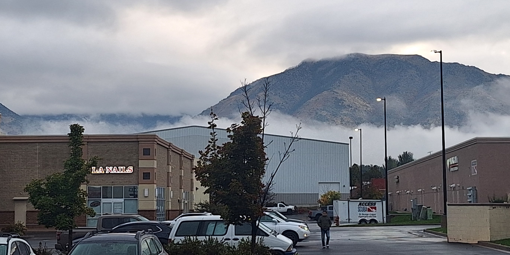
(m6fi-migration-dir-2026-1013.0815) The Overcast Skies are Clearing: Time to Drive Further South
The Drive to Moab, Utah: 317 miles
5 hours and 7 minutes
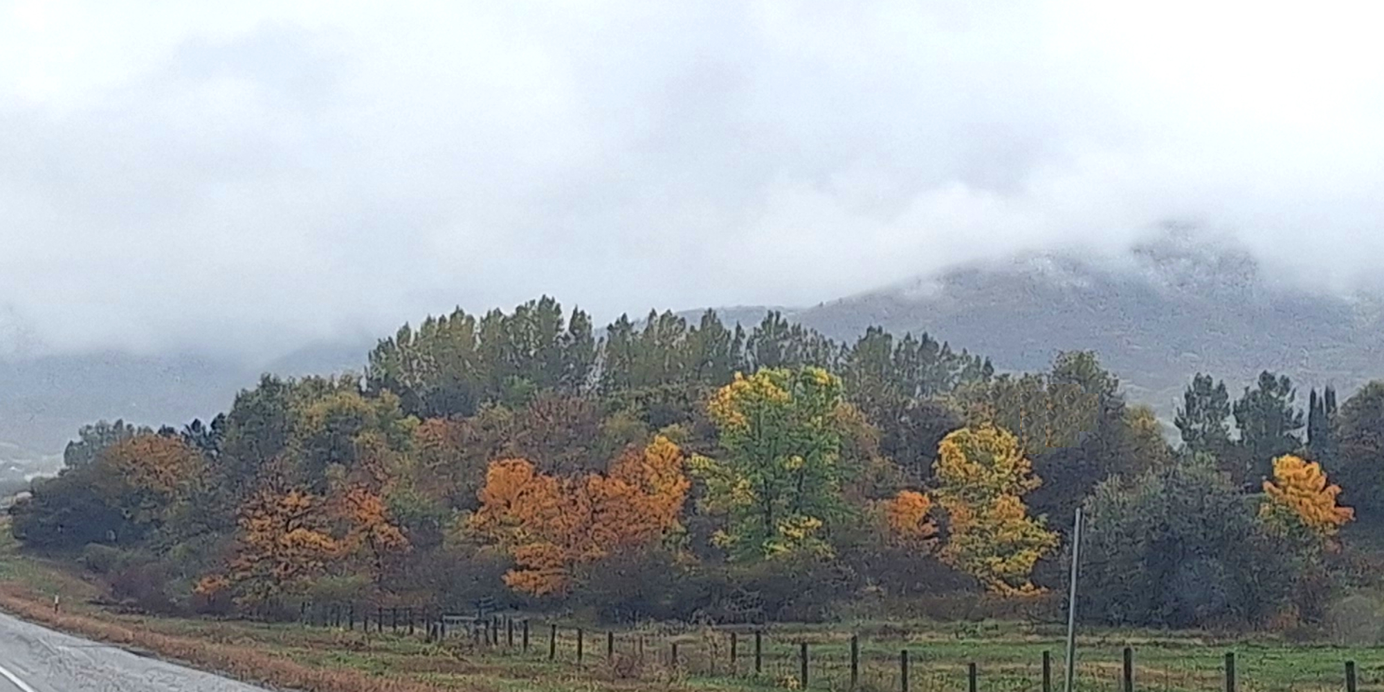
(m6fi-migration-dir-2026-1013.1130) Still Overcast, but the Fall Coors are Showing

(m6fi-migration-dir-2026-1013.1142) Still Overcast, Mountain Lake Scene
Forth Leg: Part Two
The Drive to Farmington, New Mexico: 183 miles
3 hours and 10 minutes
Journey On™ Southbound
Section Three: NM
Fifth Leg: The Drive Southeast to Brownsfield, Texas
512 miles, 8 hours
Total: 2,012 miles
Fifth Leg: Part One
The Drive to City, State: XXX miles
hours and minutes
Fifth Leg: Part Two
The Drive to City, State: XXX miles
hours and minutes
Fifth Leg: Part Three
The Drive to City, State: XXX miles
hours and minutes
Fifth Leg: Part Four
The Drive to City, State: XXX miles
hours and minutes
Journey On™ Southbound
Section Four: TX
Sixth Leg: The Drive Southeast to McAllen, Texas
623 miles, 9 hours and 15 minutes
Total: 2,635 miles
Sixth Leg: Part One
The Drive to City, State: XXX miles
hours and minutes
Sixth Leg: Part Two
The Drive to City, State: XXX miles
hours and minutes
Sixth Leg: Part Three
The Drive to City, State: XXX miles
hours and minutes
Sixth Leg: Part Four
The Drive to City, State: XXX miles
hours and minutes
Winter Sojourn Begins
Section Five: TX
Seventh Leg: The Sojourn in McAllen, Texas
|