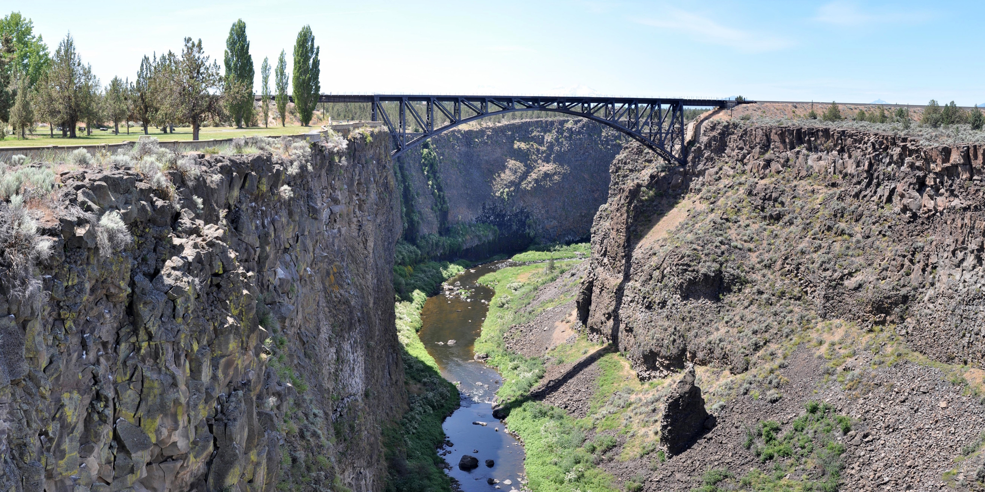
(m4bridge-arch-or-crookedriverhigh-2010-bridge) The Crooked River High Bridge
Information:
The Crooked River High Bridge is a steel arch bridge that spans the Crooked River gorge in Jefferson County, Oregon on an old alignment of US 97. The High Bridge provides one of the leading locations of scenic wonder in the central region of Oregon State.
The bridge was designed by Conde McCullough and was completed in 1926. This bridge has a total length of 464 feet (141 meters) with a 330 foot (100 meters) two-hinged steel braced-spandrel deck arch serving as the main span. The deck is 295 feet (90 m) above the canyon floor and the Crooked River below. Other features include when it was built are an ornamental concrete bridge railing and entrance pylons.
but eventually, like many of those bridges built in the early 1900′s, the High Bridge was not able to keep up with the growing traffic demands of US Highway 97 (US 97) which it carried, and thus, it was replaced in 2000 by the wider Rex T. Barber Veterans Memorial Bridge.
During the construction and in ordeer to erect the structure, a high line cableway was used to move the pieces into their places. The High Bridge is located just upstream from the Trunk Rail Bridge. In 200, the Oregon department of transportation completed the building a new bridge near the historic bridge.
Shortly after the completion of the High Bridge, Oregon State Highway Division created the Peter Skene Ogden Park just to the south of the High Bridge, which provides a place for viewing both the Crooked River Gorge and the several bridge spans across the gorge, now three in number:
The 1911 Oregon Trunk Rail Bridge: this bridge was built in 1911 and is a steel arch bridge designed by Ralph Modjeski.
The High Bridge (1926); and
The Rex T. Barber Veterans Memorial Bridge (2000)
Although auto traffic is no longer allowed on the old High Bridge, it remains open to pedestrians.
Location:
On US 97 between Madras, Oregon and Redmond, Oregon.
Driving Directions:
US 97 south from Madras, Oregon or US 97 north from Redmond, Oregon
Coordinates:
44.392093902786954, -121.19314739043979
Elevation:
2,755 feet
History:
The Crooked River was named during the fur trading period, and aptly describes this winding tributary. The city of Terrebonne is the nearest community to this bridge. The city of Terrebonne was first known as Hillman, a word made by taking parts of the names of two
prominent railroad men, James J. Hill and E.H. Harriman, whose rail lines ran a race to see which could arrive into central Oregon first. Shortly after the town of Hillman was founded, the name was changed to Terebonne, which is a French expression meaning "good earth."
Prior to the beginning of the construction of the High Bridge, there was an historic trail crossing bridge over the Crooked River Canyon near Smith Rock, which trail bridge was torn down in 1927 right after the completion of the High Bridge. The Oregon Trunk Bridge, built in 1911, is now the Burlington Northern Railroad is just downstream (west) of the High Bridge. The Rex T. Barber Veterans Memorial Bridge replaced the High Bridge in 2000 is just upstream (east) of the High Bridge.
The Peter Skene Ogden State Park, on the south side of the Crooked River Gorge is named after the pioneer who discover Dry Canyon River during the days of the Hudson Bay Company. Peter Skene Ogden was a pioneer, trader and explorer, is believed to be the first European man to penetrate into Deschutes country and discover the Crooked River. The park borders both sides of the High Bridge and was constructed during 1926-27, developed from land donated by the railroad and with small parcels purchased from the Federal Government. The construction of this bridge marked the completion of the Dalles (in the Columbia Gorge) to California Highway, one of the great Trunk highways built in Oregon.
The Crooked River High Bridge was built in 1926 and then closed to vehicles in 2000 when the new wider Rex T. Barber Veterans Memorial Bridge replaced it.
Bridge Specification
Bridge Type:
Steel Arch Deck Bridge
Bridge Deck:
Concrete
Bridge Measurements:
Deck Width:
24 feet
Total Length:
464 feet
Number of Spans:
one
Main Span Length, 1 each:
330 feet
Total Height:
Clearance Above (Vehicle Clearance)
open
Clearance Below (above streambed)
295 feet
Carries:
old alignment of US 97
Crosses:
Crooked River Gorge
Construction:
Designer:
Conde B. McCullough
Oregon State Highway Department
Builder:
Kuckenberg and Wittman, Porland, Oregon
Cost to Build:
$140,435.00
Date Construction Began:
12 August 1925
Date Construction Complete:
19 September 1926
Improvements/Rehabilitations
Replaced/Bypassed:
Year Bypassed:
2000
Bypassed By:
Rex T. Barber Veterans Memorial Bridge
| 








